
Planes topographic map
Interactive map
Click on the map to display elevation.
About this map
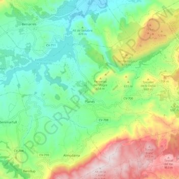
Name: Planes topographic map, elevation, terrain.
Location: Planes, el Comtat, Alicante, Communauté Valencienne, Espagne (38.75880 -0.38796 38.82233 -0.28356)
Average elevation: 523 m
Minimum elevation: 265 m
Maximum elevation: 1,013 m