Geolocate

Holland topographic map

Click on the map to display elevation.

About this map
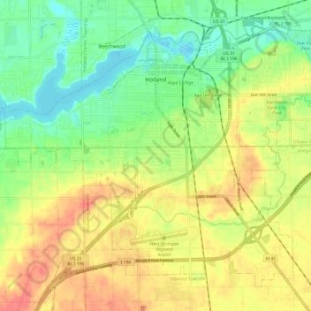
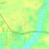
Name: Holland topographic map, elevation, terrain.

Location: Holland, Ottawa County, Michigan, 49423, United States (42.72934 -86.16699 42.80284 -86.04790)

Average elevation: 199 m

Minimum elevation: 172 m

Maximum elevation: 227 m

Other topographic maps

Click on a map to view its topography, its elevation and its terrain.
Borculo

United States > Michigan > Ottawa County > Olive Township

Average elevation: 197 m

Macatawa

United States > Michigan > Ottawa County > Park Township

Average elevation: 181 m

Aman Park

United States > Michigan > Ottawa County > Tallmadge

Average elevation: 207 m

Wright

United States > Michigan > Ottawa County > Wright Township

Average elevation: 265 m

Port Sheldon

United States > Michigan > Ottawa County

Average elevation: 185 m

Grand Valley

United States > Michigan > Ottawa County

Average elevation: 199 m

Gear up for your next adventure:

👕Technical Hiking Tees - Moisture-management for high-exertion climbs
🧼Technical Clothing Wash - Special soap to clean and restore waterproof membranes
🗺️Topographic Maps - Detailed maps showing elevation and terrain features
🧢Thermal Beanie Hats - Prevent heat loss from the head in windy summit conditions
🔋Power Banks - Portable chargers for long outdoor trips

As an Amazon Associate, this site earns from qualifying purchases at no extra cost to you.