
Medina topographic map
Click on the map to display elevation.
About this map
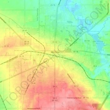
Name: Medina topographic map, elevation, terrain.
Location: Medina, Medina County, Ohio, 44256, United States (41.10902 -81.91698 41.16349 -81.81614)
Average elevation: 320 m
Minimum elevation: 271 m
Maximum elevation: 376 m
Other topographic maps
Click on a map to view its topography, its elevation and its terrain.
Chippewa Creek Structure VIII-C Dam
United States > Ohio > Medina County > River Styx
Average elevation: 325 m