
Shahin Shahr topographic map
Interactive map
Click on the map to display elevation.
Shahin Shahr
The city is among the central mountain ranges of Iran to the east of the Zagros Mountains. It has an altitude of 1662 meters on average with a slope of 16%. It has a dry climate with very little precipitation. The variation in temperature is about 50 degrees Celsius.
About this map
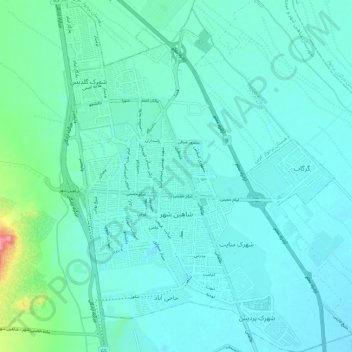
Name: Shahin Shahr topographic map, elevation, terrain.
Average elevation: 1,601 m
Minimum elevation: 1,583 m
Maximum elevation: 1,709 m