Geolocate

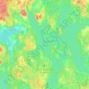
Attsjö topographic map

Click on the map to display elevation.

About this map

Name: Attsjö topographic map, elevation, terrain.

Location: Attsjö, Växjö kommun, Kronoberg County, 365 93, Sweden (56.87451 15.07163 56.91451 15.11163)

Average elevation: 219 m

Minimum elevation: 181 m

Maximum elevation: 254 m

Other topographic maps

Click on a map to view its topography, its elevation and its terrain.
Helgasjön

Sweden > Kronoberg County > Åby

Average elevation: 173 m

Växjö kommun

Sweden > Kronoberg County

Average elevation: 191 m

Lessebo kommun

Sweden > Kronoberg County

Average elevation: 178 m

Tingsryds kommun

Sweden > Kronoberg County

Average elevation: 138 m

Markaryds kommun

Sweden > Kronoberg County

Average elevation: 137 m

England

Sweden > Kronoberg County > Markaryd

Average elevation: 107 m

Gear up for your next adventure:

🚲Bikepacking Frame Bags - Storage for tools and navigation gear on long off-road rides
🗺️Topographic Maps - Detailed maps showing elevation and terrain features
❄️Walking Crampons - Added traction for icy slopes and winter peak bagging
🚲Cycling GPS Computers - Track elevation and topographic routes on two wheels
👟Women's Trail Running Shoes - Agile footwear for fell running and technical trails

As an Amazon Associate, this site earns from qualifying purchases at no extra cost to you.