Geolocate

Al Rashidiya topographic map

Click on the map to display elevation.

About this map
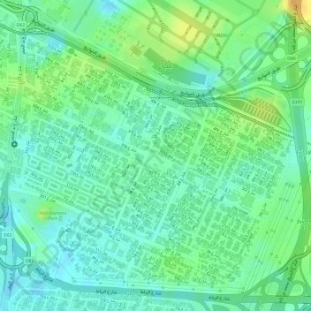
Name: Al Rashidiya topographic map, elevation, terrain.

Location: Al Rashidiya, Dubai, Dubai Emirate, United Arab Emirates (25.21232 55.37638 25.23709 55.40510)

Average elevation: 16 m

Minimum elevation: 3 m

Maximum elevation: 34 m

Other topographic maps

Click on a map to view its topography, its elevation and its terrain.

Gear up for your next adventure:

🔪Outdoor Multi-Tools - Versatile tools for gear repairs and food prep in the wild
🧤Thermal Touchscreen Gloves - Stay warm while operating your GPS or smartphone camera
🦟Anti-Midge & Tick Repellent - Vital for hiking in the Scottish Highlands during summer
🧦Merino Wool Hiking Socks - Moisture-wicking socks to prevent blisters during long mountain walks
🗺️Ordnance Survey Maps - Essential paper maps for hiking across the UK national parks

As an Amazon Associate, this site earns from qualifying purchases at no extra cost to you.