
Le Doiran topographic map
Interactive map
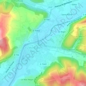
Click on the map to display elevation.
About this map
Name: Le Doiran topographic map, elevation, terrain.
Average elevation: 116 m
Minimum elevation: 70 m
Maximum elevation: 230 m
Other topographic maps
Click on a map to view its topography, its elevation and its terrain.
Montignac
France > New Aquitaine > Montignac
Montignac, Langon, New Aquitaine, Metropolitan France, 33760, France
Average elevation: 73 m