Geolocate

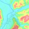
Monterey topographic map

Click on the map to display elevation.

About this map

Name: Monterey topographic map, elevation, terrain.

Location: Monterey, Owen County, Kentucky, United States (38.41865 -84.87955 38.42839 -84.86639)

Average elevation: 185 m

Minimum elevation: 132 m

Maximum elevation: 270 m

Other topographic maps

Click on a map to view its topography, its elevation and its terrain.
Perry Park

United States > Kentucky > Owen County

Average elevation: 173 m

New Liberty

United States > Kentucky > Owen County

Average elevation: 253 m

Breck

United States > Kentucky > Owen County

Average elevation: 247 m

New Liberty

United States > Kentucky > Owen County

Average elevation: 253 m

Gear up for your next adventure:

🥾Trekking Poles - Poles to improve stability on uneven terrain
🎒Backpack Rain Covers - Universal waterproof covers to protect your gear from downpours
🎒Replacement Sternum Straps - Repair parts for hiking rucksacks
🧥Packable Down Jackets - Lightweight warmth that compresses small in your bag
🎒Hiking Child Carriers - Explore the outdoors with the whole family safely

As an Amazon Associate, this site earns from qualifying purchases at no extra cost to you.