Geolocate

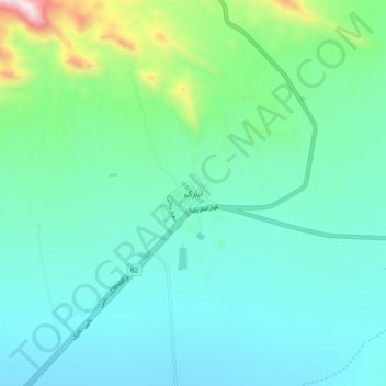
Anarak topographic map

Click on the map to display elevation.

Anarak

Anarak is at an altitude of 1,429 metres (4,688 ft) at the edge of the "Dasht-e Kavir" and about 75 kilometres (47 mi) from the city of Nain. The city is surrounded by ruins of an old wall and three watchtowers, which were built about 100 years ago to keep Hossein Kashi and his bandit gang out. There is little agriculture in this region, but there are many mines located near Anarak. Nakhlalk, a lead mine, is the largest active mine near Anarak.

Wikipedia (CC-BY-SA 3.0)

About this map

Name: Anarak topographic map, elevation, terrain.

Location: Anarak, دهستان چوپانان, بخش انارک, Nain County, Isfahan Province, Iran (33.27041 53.65815 33.35041 53.73815)

Average elevation: 1,515 m

Minimum elevation: 1,324 m

Maximum elevation: 2,341 m

Gear up for your next adventure:

🔥Reusable Hand Warmers - Maintain dexterity in your fingers for precise map handling
🍱Food Containers - Reusable containers for outdoor meals
👖Convertible Hiking Trousers - Versatile zip-off pants for changing mountain weather conditions
📱Phone Mounts for Hiking - Secure mounts to carry your phone on trails
🔋Rechargeable Batteries - Eco-friendly power for headlamps and older GPS units

As an Amazon Associate, this site earns from qualifying purchases at no extra cost to you.