
Oromiya topographic map
Interactive map
Click on the map to display elevation.
About this map
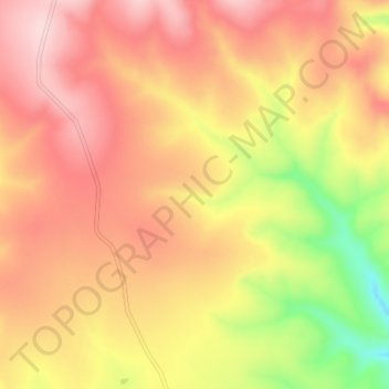
Name: Oromiya topographic map, elevation, terrain.
Location: Oromiya, Arsi, ኦሮሚያ ክልል, Ethiopië (7.84906 40.48941 7.88906 40.52941)
Average elevation: 1,282 m
Minimum elevation: 1,119 m
Maximum elevation: 1,373 m
Other topographic maps
Click on a map to view its topography, its elevation and its terrain.
በቆጂ / Bekoji
Ethiopië > ኦሮሚያ ክልል > በቆጂ / Bekoji
በቆጂ / Bekoji, Arsi, ኦሮሚያ ክልል, Ethiopië
Average elevation: 2,792 m