Geolocate

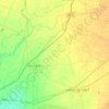
Yazman topographic map

Click on the map to display elevation.

About this map

Name: Yazman topographic map, elevation, terrain.

Location: Yazman, Yazman Tehsil, Bahawalpur District, Bahawalpur Division, Punjab, 63210, Pakistan (29.08423 71.70832 29.16423 71.78832)

Average elevation: 120 m

Minimum elevation: 117 m

Maximum elevation: 127 m

Other topographic maps

Click on a map to view its topography, its elevation and its terrain.
Gear up for your next adventure:

🧊Personal Water Filters - Drink safely from mountain streams marked on your map
🔋Rechargeable Batteries - Eco-friendly power for headlamps and older GPS units
🧥Breathable Waterproof Jackets - Essential rain protection for the unpredictable British climate
☕Insulated Travel Mugs - Keep drinks hot while surveying the landscape from a summit
🗺️Ordnance Survey Maps - Essential paper maps for hiking across the UK national parks

As an Amazon Associate, this site earns from qualifying purchases at no extra cost to you.