
Vorniceni topographic map
Interactive map
Click on the map to display elevation.
About this map
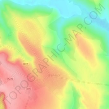
Name: Vorniceni topographic map, elevation, terrain.
Location: Vorniceni, Botoșani, 717470, Romania (47.96773 26.63775 47.99741 26.68704)
Average elevation: 171 m
Minimum elevation: 108 m
Maximum elevation: 226 m
Other topographic maps
Click on a map to view its topography, its elevation and its terrain.