Geolocate

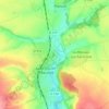
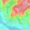
Remy topographic map

Click on the map to display elevation.

About this map

Name: Remy topographic map, elevation, terrain.

Location: Remy, Compiègne, Oise, Hauts-de-France, Metropolitan France, 60190, France (49.41115 2.65825 49.47177 2.74011)

Average elevation: 75 m

Minimum elevation: 39 m

Maximum elevation: 107 m

Other topographic maps

Click on a map to view its topography, its elevation and its terrain.
Blainville

France > Hauts-de-France > Oise > Ponchon

Average elevation: 96 m

La Faïencerie

France > Hauts-de-France > Oise > Liancourt

Average elevation: 80 m

Crécy

France > Hauts-de-France > Oise > Saint-Sulpice

Average elevation: 117 m

Uny-Saint-Georges

France > Hauts-de-France > Oise > Rantigny

Average elevation: 69 m

Fond Crépy

France > Hauts-de-France > Oise > Chevincourt

Average elevation: 92 m

Chemin de l'Église

France > Hauts-de-France > Oise > Plainval

Average elevation: 114 m

Gear up for your next adventure:

🪓Outdoor Multitools - Versatile tools for hiking and camping
🧺Microfibre Travel Towels - Fast-drying and compact towels for wild swimming and camping
🥤Hiking Water Bottles - Reusable bottles for hydration on the trail
🔥Emergency Fire Starters - Reliable ignition tools for survival situations in damp conditions
📚UK Hiking Guidebooks - Detailed route descriptions for the Lake District, Peaks, and Highlands

As an Amazon Associate, this site earns from qualifying purchases at no extra cost to you.