
Huai Sai Dai topographic map
Interactive map
Click on the map to display elevation.
About this map
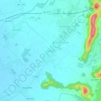
Name: Huai Sai Dai topographic map, elevation, terrain.
Location: Huai Sai Dai, Lamphun Province, Thailand (18.66944 99.13538 18.70944 99.17538)
Average elevation: 325 m
Minimum elevation: 307 m
Maximum elevation: 438 m