
Utulei topographic map
Interactive map
Click on the map to display elevation.
About this map
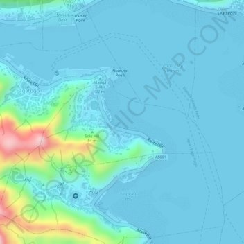
Name: Utulei topographic map, elevation, terrain.
Average elevation: 33 m
Minimum elevation: -1 m
Maximum elevation: 260 m
Other topographic maps
Click on a map to view its topography, its elevation and its terrain.
Palapala Mountain
United States > American Samoa > Eastern District > Masefau
Average elevation: 159 m