
Ewuaso Oonkidong'i ward topographic map
Interactive map
Click on the map to display elevation.
About this map
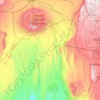
Name: Ewuaso Oonkidong'i ward topographic map, elevation, terrain.
Average elevation: 1,580 m
Minimum elevation: 887 m
Maximum elevation: 2,442 m
Other topographic maps
Click on a map to view its topography, its elevation and its terrain.
Mount Suswa
Kenya > Kajiado County > Kajiado West > Ewuaso Oonkidong'i ward
Average elevation: 2,044 m