
Clifton Hampden topographic map
Interactive map
Click on the map to display elevation.
About this map
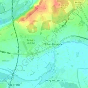
Name: Clifton Hampden topographic map, elevation, terrain.
Average elevation: 58 m
Minimum elevation: 44 m
Maximum elevation: 96 m
Oxfordshire trails, hiking, mountain biking, running and outdoor activities
Other topographic maps
Click on a map to view its topography, its elevation and its terrain.
Burcot
United Kingdom > England > Oxfordshire > South Oxfordshire > Clifton Hampden
Average elevation: 59 m