
Thank you for supporting this site ❤️
Make a donation
Make a donation
Gear up for your next adventure:
As an Amazon Associate, this site earns from qualifying purchases at no extra cost to you.
Beddgelert topographic map
Click on the map to display elevation.
Thank you for supporting this site ❤️
Make a donation
Make a donation
Gear up for your next adventure:
As an Amazon Associate, this site earns from qualifying purchases at no extra cost to you.
About this map
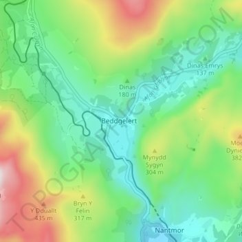
Name: Beddgelert topographic map, elevation, terrain.
Location: Beddgelert, Gwynedd, Wales, LL55 4YA, United Kingdom (52.99155 -4.12223 53.03155 -4.08223)
Average elevation: 199 m
Minimum elevation: 4 m
Maximum elevation: 616 m
Wales trails, hiking, mountain biking, running and outdoor activities
Thank you for supporting this site ❤️
Make a donation
Make a donation
Gear up for your next adventure:
As an Amazon Associate, this site earns from qualifying purchases at no extra cost to you.