Geolocate

Lapa topographic map

Click on the map to display elevation.

About this map
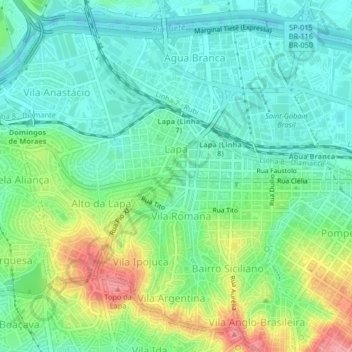
Name: Lapa topographic map, elevation, terrain.

Location: Lapa, São Paulo, Southeast Region, Brazil (-23.54103 -46.72624 -23.50795 -46.68528)

Average elevation: 748 m

Minimum elevation: 714 m

Maximum elevation: 823 m

Other topographic maps

Click on a map to view its topography, its elevation and its terrain.

Ibirapuera Park

Brazil > São Paulo > São Paulo

Average elevation: 760 m

Gear up for your next adventure:

🥤Hydration Bladders - Hands-free hydration systems for backpacks
🧤Hiking Gloves - Warm and durable gloves for cold-weather walks
🎒Hiking Daypacks (20L) - Compact backpacks for day trips and technical mountain ascents
🔦LED Camping Lanterns - Illumination for reading maps inside your tent at night
🎒Hiking Child Carriers - Explore the outdoors with the whole family safely

As an Amazon Associate, this site earns from qualifying purchases at no extra cost to you.