
Thank you for supporting this site ❤️
Make a donation
Make a donation
Gear up for your next adventure:
As an Amazon Associate, this site earns from qualifying purchases at no extra cost to you.
Jubbar topographic map
Click on the map to display elevation.
Thank you for supporting this site ❤️
Make a donation
Make a donation
Gear up for your next adventure:
As an Amazon Associate, this site earns from qualifying purchases at no extra cost to you.
About this map
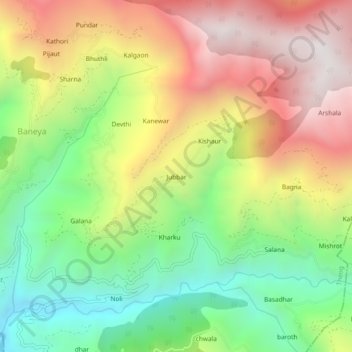
Name: Jubbar topographic map, elevation, terrain.
Location: Jubbar, Theog, Shimla, Himachal Pradesh, 171226, India (30.99664 77.42214 31.03664 77.46214)
Average elevation: 1,915 m
Minimum elevation: 1,243 m
Maximum elevation: 2,686 m
Thank you for supporting this site ❤️
Make a donation
Make a donation
Gear up for your next adventure:
As an Amazon Associate, this site earns from qualifying purchases at no extra cost to you.