Geolocate

Evesham topographic map

Click on the map to display elevation.

About this map
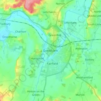
Name: Evesham topographic map, elevation, terrain.

Location: Evesham, Worcestershire, West Midlands, England, WR11, United Kingdom (52.05402 -1.98831 52.13402 -1.90831)

Average elevation: 42 m

Minimum elevation: 17 m

Maximum elevation: 126 m

England trails, hiking, mountain biking, running and outdoor activities

Gear up for your next adventure:

👟Heavy Duty Boot Laces - Always carry a spare for your hiking footwear
👟Men's Trail Running Shoes - Lightweight grip for fast movement over topographic contours
🐕Dog Hiking Gear - Equipment for hiking safely with dogs
📍Handheld GPS Navigators - Reliable satellite navigation for hiking and off-road exploration
🔦Outdoor Torches - Reliable torches for night navigation

As an Amazon Associate, this site earns from qualifying purchases at no extra cost to you.