
Paunti topographic map
Interactive map
Click on the map to display elevation.
About this map
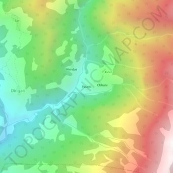
Name: Paunti topographic map, elevation, terrain.
Location: Paunti, Puraula, Uttarkashi district, Uttarakhand, India (30.92740 78.21579 30.96740 78.25579)
Average elevation: 2,439 m
Minimum elevation: 1,801 m
Maximum elevation: 3,345 m
Other topographic maps
Click on a map to view its topography, its elevation and its terrain.