
Hosingen topographic map
Interactive map
Click on the map to display elevation.
About this map
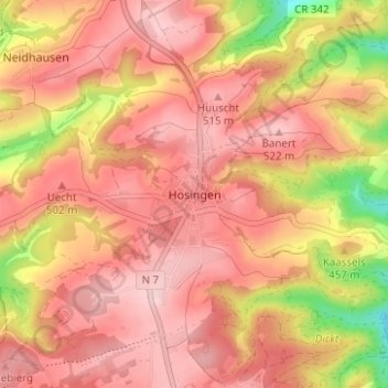
Name: Hosingen topographic map, elevation, terrain.
Location: Hosingen, Parc Hosingen, Canton Clervaux, 9806, Luxemburg (49.99435 6.07109 50.03435 6.11109)
Average elevation: 464 m
Minimum elevation: 327 m
Maximum elevation: 530 m