
Burj Umar Idris topographic map
Interactive map
Click on the map to display elevation.
Burj Umar Idris
Bordj Omar Driss lies at an elevation of 354 metres (1,161 ft) at the south-western end of the Hamada de Tinrhert Desert, a vast rocky region of the Sahara Desert that extends eastwards into Libya. To the south of the town is an area of sand dunes, beyond which lies the mountain range Djebel Essaoui Mellene, an extension of the Tassili n'Ajjer range.
About this map
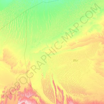
Name: Burj Umar Idris topographic map, elevation, terrain.
Location: Burj Umar Idris, In Amenas District, Illizi, 33003, Algeria (26.26393 5.63844 30.14219 8.93103)
Average elevation: 440 m
Minimum elevation: 214 m
Maximum elevation: 1,508 m