
Juliaetta topographic map
Interactive map
Click on the map to display elevation.
About this map
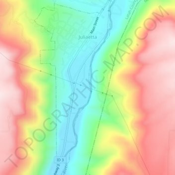
Name: Juliaetta topographic map, elevation, terrain.
Location: Juliaetta, Latah County, Idaho, 83535, United States (46.55671 -116.71841 46.58455 -116.70008)
Average elevation: 515 m
Minimum elevation: 312 m
Maximum elevation: 726 m
Other topographic maps
Click on a map to view its topography, its elevation and its terrain.
Moscow
United States > Idaho > Latah County
Moscow, Latah County, Idaho, United States
Average elevation: 804 m
Troy
United States > Idaho > Latah County
Troy, Latah County, Idaho, United States
Average elevation: 811 m
Deary
United States > Idaho > Latah County > Deary
Deary, Latah County, Idaho, 88382, United States
Average elevation: 909 m