
Hwachon-myeon topographic map
Interactive map
Click on the map to display elevation.
About this map
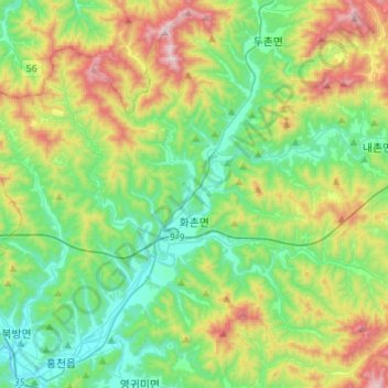
Name: Hwachon-myeon topographic map, elevation, terrain.
Location: Hwachon-myeon, Hongcheon-gun, Gangwon State, South Korea (37.69199 127.85465 37.87135 128.12499)
Average elevation: 379 m
Minimum elevation: 113 m
Maximum elevation: 985 m
Other topographic maps
Click on a map to view its topography, its elevation and its terrain.