
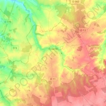
Écueillé topographic map
Interactive map
Click on the map to display elevation.
About this map
Name: Écueillé topographic map, elevation, terrain.
Average elevation: 157 m
Minimum elevation: 111 m
Maximum elevation: 191 m
Other topographic maps
Click on a map to view its topography, its elevation and its terrain.
Issoudun
Frankreich > Zentrum-Loiretal > Indre
Issoudun, Indre, Zentrum-Loiretal, Metropolitanes Frankreich, 36100, Frankreich
Average elevation: 149 m
Lacs
Frankreich > Zentrum-Loiretal > Indre
Lacs, La Châtre, Indre, Zentrum-Loiretal, Metropolitanes Frankreich, 36400, Frankreich
Average elevation: 224 m
Châteauroux
Frankreich > Zentrum-Loiretal > Indre > Châteauroux
Châteauroux, Indre, Zentrum-Loiretal, Metropolitanes Frankreich, 36000, Frankreich
Average elevation: 153 m