
Ledeng topographic map
Interactive map
Click on the map to display elevation.
About this map
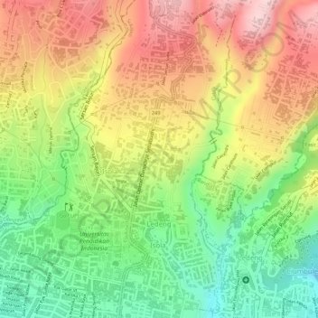
Name: Ledeng topographic map, elevation, terrain.
Location: Ledeng, Cidadap, Bandung, West Java, Java, Indonesia (-6.86717 107.59411 -6.84123 107.60375)
Average elevation: 956 m
Minimum elevation: 820 m
Maximum elevation: 1,084 m
Other topographic maps
Click on a map to view its topography, its elevation and its terrain.