Geolocate

Alibeyköy topographic map

Interactive map

Click on the map to display elevation.

About this map

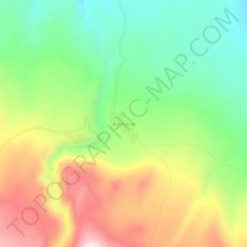
Name: Alibeyköy topographic map, elevation, terrain.

Location: Alibeyköy, Iğdır, Eastern Anatolia Region, Turkey (39.79808 43.92000 39.83808 43.96000)

Average elevation: 1,781 m

Minimum elevation: 1,518 m

Maximum elevation: 2,140 m

Other topographic maps

Click on a map to view its topography, its elevation and its terrain.

Mount Ararat

Turkey > Iğdır

Mount Ararat is a snow-capped and dormant compound volcano in the extreme east of Turkey. It consists of two major volcanic cones: Greater Ararat and Little Ararat. Greater Ararat is the highest peak in Turkey and the Armenian Highland with an elevation of 5,137 m (16,854 ft); Little Ararat's elevation is…

Average elevation: 4,582 m