Turkey topographic maps
Click on a map to view its topography, its elevation and its terrain.


Salihli
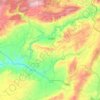
The city of Salihli, the seat of the district, is located on İzmir-Ankara (E 96) highway and the parallel railway connections. The urban zone is situated on the slopes of Bozdağ mountain chain along the southern alluvial plains of the Gediz River. To the north and northeast of the plain extend two other…
Average elevation: 157 m

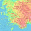
Anatolia
Anatolia (Turkish: Anadolu), also known as Asia Minor, is a peninsula in West Asia that makes up the majority of the land area of Turkey. It is the westernmost protrusion of Asia and is geographically bounded by the Mediterranean Sea to the south, the Aegean Sea to the west, the Turkish Straits to the…
Average elevation: 518 m

Adana
Aladağlar National Park, located north of Adana, is a huge park of around 55,000 hectares, the summit of Demirkazik at 3756m is the highest point in the middle Taurus mountain range. There is a huge range of flora and fauna, and visitors may fish in the streams full of trout. Wildlife includes wild goats,…
Average elevation: 879 m


Turhal
Turhal is a city in Tokat Province in the Black Sea region of Turkey. It is the seat of Turhal District. Its population is 62,030 (2022). It is 48 km to the west of Tokat. Turhal is situated on a fertile plain fragmented by the Yeşil Irmak river. It has an elevation of approximately 530 m. The city is best…
Average elevation: 956 m

Lake Van
Lake Van (Turkish: Van Gölü; Armenian: Վանա լիճ, romanized: Vana lič̣; Kurdish: Gola Wanê) is the largest lake in Turkey.[3][4] It lies in the far east of Turkey, in the provinces of Van and Bitlis in the Armenian highlands. It is a saline soda lake, receiving water from many small streams that…
Average elevation: 1,902 m
Black Sea Region
The Black Sea region has a steep, rocky coast with rivers that cascade through the gorges of the coastal ranges. A few larger rivers, those cutting back through the Pontic Mountains (Doğu Karadeniz Dağları), have tributaries that flow in broad, elevated basins. Access inland from the coast is limited to a…
Average elevation: 817 m

Kızılcahamam
Kızılcahamam is a town and district of Ankara Province in the Central Anatolia region of Turkey, 70 km north of the city of Ankara, near the motorway to Istanbul. According to 2010 census, population of the district is 25,203 of which 16,726 live in the town of Kızılcahamam. The district covers an area of…
Average elevation: 1,367 m

Polatlı
Polatlı (formerly Ancient Greek: Γόρδιον, Górdion and Latin: Gordium) is a city and a district in Ankara Province in the Central Anatolia region of Turkey, 80 km west of the Turkish capital Ankara, on the road to Eskişehir. According to 2019 census, population of the district is 125,075 of which…
Average elevation: 889 m
Erdek
Erdek (formerly known as Artàke, Greek: Αρτάκη) is a municipality and district of Balıkesir Province, Turkey. Its area is 307 km2, and its population is 31,902 (2022). Located on the Kapıdağ Peninsula, on the north coast of the Gulf of Erdek at the south of the Sea of Marmara, Erdek is a popular…
Average elevation: 68 m

Çivril
Çivril district area is notable by the large size within its boundaries of Lake Işıklı, a freshwater lake which is a fishing reserve and recreational are for its region, aside from being one of the sources of Büyük Menderes River. The lake lies at an altitude of 821 m and its area is 73 square…
Average elevation: 996 m




Asia Minor
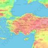
Anatolia (Turkish: Anadolu), also known as Asia Minor, is a peninsula in West Asia that makes up the majority of the land area of Turkey. It is the westernmost protrusion of Asia and is geographically bounded by the Mediterranean Sea to the south, the Aegean Sea to the west, the Turkish Straits to the…
Average elevation: 399 m

Hasan Dağı
The volcano has two summits, the 3,069 metres (10,069 ft) high eastern Small Hasan Dagi/Küçük Hasandağ and the 3,253 metres (10,673 ft) high Big Hasan Dagi/Büyük Hasandağ; both are located within a caldera and consist of lava domes and lava flows. Big Hasan Dagi has two nested craters with an 800 metres…
Average elevation: 2,707 m



Mount Erciyes
The climate of the region is influenced by topography, with the Taurus and Kaçkar Mountains blocking the entry of moisture into Anatolia. Summers are dry and hot and winters wet and cold; in Kayseri, summer temperatures are about 19 °C (66 °F) and winter temperature about 0 °C (32 °F). Precipitation at…
Average elevation: 3,329 m

Dilek Peninsula National Park
Dilek Peninsula-Büyük Menderes Delta National Park has a Mediterranean climate (Köppen climate classification Csa), and as such, it is dry and mild throughout most of the year, except during the winters, when most of the yearly precipitation occurs. The average temperature year-round is about 18 °C (64…
Average elevation: 100 m


Mount Suphan
Mount Süphan (Turkish: Süphan Dağı; Kurdish: Sîpanê Xelatê; Armenian: Սիփան, Sipan) is a stratovolcano located in eastern Turkey, immediately north of Lake Van. It is the second highest volcano in Turkey, with an elevation of 4,058 metres (13,314 feet), and has the third highest prominence of the…
Average elevation: 3,757 m

Pontic Mountains
Winter conditions are very harsh, and snow even in summer months isn't unusual above certain elevations.
Average elevation: 2,800 m