Geolocate

Bodrum topographic map

Click on the map to display elevation.

About this map

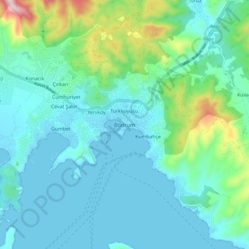
Name: Bodrum topographic map, elevation, terrain.

Location: Bodrum, Muğla, Aegean Region, 48400, Turkey (36.99952 27.39339 37.07952 27.47339)

Average elevation: 121 m

Minimum elevation: -1 m

Maximum elevation: 640 m

Gear up for your next adventure:

🧣Neck Gaiters - Versatile protection against wind and cold
🔭Compact Hiking Binoculars - Lightweight optics for scouting terrain and spotting wildlife
🗺️Topographic Maps - Detailed maps showing elevation and terrain features
🚶Walking Pedometers - Simple distance tracking for casual trail walkers
🧥Softshell Jackets - Breathable jackets for active outdoor use

As an Amazon Associate, this site earns from qualifying purchases at no extra cost to you.