
Altikon topographic map
Interactive map
Click on the map to display elevation.
About this map
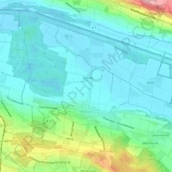
Name: Altikon topographic map, elevation, terrain.
Location: Altikon, Bezirk Winterthur, Zurich, 8479, Switzerland (47.56368 8.76146 47.59286 8.81023)
Average elevation: 406 m
Minimum elevation: 370 m
Maximum elevation: 524 m
Other topographic maps
Click on a map to view its topography, its elevation and its terrain.