
Heaven Lake topographic map
Interactive map
Click on the map to display elevation.
Heaven Lake
The caldera which contains Heaven Lake was created by the 946 eruption of Paektu Mountain. The lake has a surface elevation of 2,189.1 m (7,182 ft). The lake covers an area of 9.82 km2 (3.79 sq mi), with a south–north length of 4.85 km (3.01 mi) and an east–west length of 3.35 km (2.08 mi). The average depth of the lake is 213 m (699 ft) and a maximum depth of 384 m (1,260 ft). From mid-October to mid-June, it is typically covered with ice.
About this map
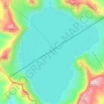
Name: Heaven Lake topographic map, elevation, terrain.
Location: Heaven Lake, Samjiyon, Ryanggang, North Korea (41.98454 128.03688 42.02719 128.08102)
Average elevation: 2,305 m
Minimum elevation: 2,132 m
Maximum elevation: 2,743 m