
Fraserburg topographic map
Interactive map
Click on the map to display elevation.
Fraserburg
Fraserburg is situated at an altitude of 1,385 metres (4,544 ft) above sea level on a high Karoo plateau, north of the Nuweveld Mountains.
About this map
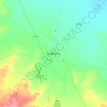
Name: Fraserburg topographic map, elevation, terrain.
Average elevation: 1,268 m
Minimum elevation: 1,234 m
Maximum elevation: 1,342 m
Other topographic maps
Click on a map to view its topography, its elevation and its terrain.
Karoo Hoogland Local Municipality
South Africa > Northern Cape > Namakwa District Municipality > Karoo Hoogland Local Municipality
Average elevation: 1,101 m