Geolocate

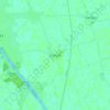
Frampton CP topographic map

Click on the map to display elevation.

About this map

Name: Frampton CP topographic map, elevation, terrain.

Location: Frampton CP, Boston, Lincolnshire, England, United Kingdom (52.91117 -0.12475 52.98703 0.03354)

Average elevation: 4 m

Minimum elevation: -1 m

Maximum elevation: 9 m

Lincolnshire trails, hiking, mountain biking, running and outdoor activities

Other topographic maps

Click on a map to view its topography, its elevation and its terrain.

North End

United Kingdom > England > Lincolnshire > Boston

Average elevation: 4 m

Frampton

United Kingdom > England > Lincolnshire > Boston

Average elevation: 4 m

Holland Fen

United Kingdom > England > Lincolnshire > Boston

Average elevation: 3 m

Fishtoft

United Kingdom > England > Lincolnshire > Boston

Average elevation: 4 m

Fosdyke

United Kingdom > England > Lincolnshire > Boston

Average elevation: 4 m

Leverton

United Kingdom > England > Lincolnshire > Boston

Average elevation: 4 m

Wigtoft

United Kingdom > England > Lincolnshire > Boston

Average elevation: 4 m

Swineshead

United Kingdom > England > Lincolnshire > Boston

Average elevation: 4 m

Drayton

United Kingdom > England > Lincolnshire > Boston > Swineshead

Average elevation: 4 m

Bicker Fen

United Kingdom > England > Lincolnshire > Boston

Average elevation: 3 m

Cowbridge

United Kingdom > England > Lincolnshire > Boston

Average elevation: 4 m

Freiston

United Kingdom > England > Lincolnshire > Boston

Average elevation: 4 m

Wrangle

United Kingdom > England > Lincolnshire > Boston

Average elevation: 3 m

Bicker Bar

United Kingdom > England > Lincolnshire > Boston

Average elevation: 4 m

Wyberton

United Kingdom > England > Lincolnshire > Boston

Average elevation: 4 m

Old Leake

United Kingdom > England > Lincolnshire > Boston

Average elevation: 3 m

North End

United Kingdom > England > Lincolnshire > Boston

Average elevation: 4 m

Gear up for your next adventure:

💧Hydration Reservoirs - Convenient water bladders for hands-free drinking on the move
👕Technical Hiking Tees - Moisture-management for high-exertion climbs
⛺Lightweight Tents - Compact tents for backpacking and trekking
🚲Cycling GPS Computers - Track elevation and topographic routes on two wheels
🧥Packable Down Jackets - Lightweight warmth that compresses small in your bag

As an Amazon Associate, this site earns from qualifying purchases at no extra cost to you.