
Make a donation
Gear up for your next adventure:
As an Amazon Associate, this site earns from qualifying purchases at no extra cost to you.
Tulare topographic map
Click on the map to display elevation.
Make a donation
Gear up for your next adventure:
As an Amazon Associate, this site earns from qualifying purchases at no extra cost to you.
About this map
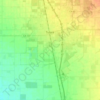
Name: Tulare topographic map, elevation, terrain.
Location: Tulare, Tulare County, California, 93274, United States (36.12347 -119.39285 36.24776 -119.29580)
Average elevation: 84 m
Minimum elevation: 70 m
Maximum elevation: 101 m
Make a donation
Gear up for your next adventure:
As an Amazon Associate, this site earns from qualifying purchases at no extra cost to you.
Other topographic maps
Click on a map to view its topography, its elevation and its terrain.
Mount Whitney
United States > California > Tulare County
Mount Whitney (Paiute: Tumanguya; Too-man-i-goo-yah) is the highest mountain in the contiguous United States and the Sierra Nevada, with an elevation of 14,505 feet (4,421 m). It is in East–Central California, on the boundary between California's Inyo and Tulare counties, 84.6 miles (136.2 km) west-northwest…
Average elevation: 3,903 m
Make a donation
Gear up for your next adventure:
As an Amazon Associate, this site earns from qualifying purchases at no extra cost to you.
Make a donation
Gear up for your next adventure:
As an Amazon Associate, this site earns from qualifying purchases at no extra cost to you.
Make a donation
Gear up for your next adventure:
As an Amazon Associate, this site earns from qualifying purchases at no extra cost to you.
Make a donation
Gear up for your next adventure:
As an Amazon Associate, this site earns from qualifying purchases at no extra cost to you.
Make a donation
Gear up for your next adventure:
As an Amazon Associate, this site earns from qualifying purchases at no extra cost to you.
Make a donation
Gear up for your next adventure:
As an Amazon Associate, this site earns from qualifying purchases at no extra cost to you.
Make a donation
Gear up for your next adventure:
As an Amazon Associate, this site earns from qualifying purchases at no extra cost to you.
Mount Whitney
United States > California > Tulare County
Mount Whitney (Paiute: Too-man-i-goo-yah or Too-man-go-yah) is the highest mountain in the contiguous United States, with an elevation of 14,505 feet (4,421 m). It is in East–Central California, in the Sierra Nevada, on the boundary between California's Inyo and Tulare counties, and 84.6 miles (136.2 km)…
Average elevation: 3,903 m
Make a donation
Gear up for your next adventure:
As an Amazon Associate, this site earns from qualifying purchases at no extra cost to you.
Make a donation
Gear up for your next adventure:
As an Amazon Associate, this site earns from qualifying purchases at no extra cost to you.
Mount Whitney
United States > California > Tulare County
Mount Whitney (Paiute: Tumanguya; Too-man-i-goo-yah) is the highest mountain in the contiguous United States and the Sierra Nevada, with an elevation of 14,505 feet (4,421 m). It is in East–Central California, on the boundary between California's Inyo and Tulare counties, 84.6 miles (136.2 km) west-northwest…
Average elevation: 3,903 m
Make a donation
Gear up for your next adventure:
As an Amazon Associate, this site earns from qualifying purchases at no extra cost to you.
Allensworth
United States > California > Tulare County
Allensworth sits at an elevation of 213 feet (65 m), the same elevation as the huge and historically important Tulare Lake shore when it was full. The community is located in the ZIP Code 93219 and in the area code 661.
Average elevation: 63 m
Make a donation
Gear up for your next adventure:
As an Amazon Associate, this site earns from qualifying purchases at no extra cost to you.
Poplar
United States > California > Tulare County > Poplar-Cotton Center > Poplar
Average elevation: 115 m