
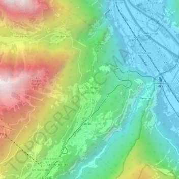
Les Granges (Salvan) topographic map
Interactive map
Click on the map to display elevation.
About this map
Name: Les Granges (Salvan) topographic map, elevation, terrain.
Average elevation: 1,085 m
Minimum elevation: 447 m
Maximum elevation: 2,303 m
Other topographic maps
Click on a map to view its topography, its elevation and its terrain.
Finhaut
Switzerland > Wallis > Saint-Maurice
Finhaut, Saint-Maurice, Wallis, 1925, Switzerland
Average elevation: 1,730 m
Mex (VS)
Switzerland > Wallis > Saint-Maurice
Mex (VS), Saint-Maurice, Wallis, 1890, Switzerland
Average elevation: 957 m
Van d'en Haut
Switzerland > Wallis > Saint-Maurice > Salvan > Van d'en Haut
Van d'en Haut, Salvan, Saint-Maurice, Wallis, 1922, Switzerland
Average elevation: 1,647 m