
Thank you for supporting this site ❤️
Make a donation
Make a donation
Gear up for your next adventure:
As an Amazon Associate, this site earns from qualifying purchases at no extra cost to you.
Caracucho topographic map
Click on the map to display elevation.
Thank you for supporting this site ❤️
Make a donation
Make a donation
Gear up for your next adventure:
As an Amazon Associate, this site earns from qualifying purchases at no extra cost to you.
About this map
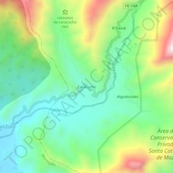
Name: Caracucho topographic map, elevation, terrain.
Location: Caracucho, Santo Domingo, Morropón, Piura, Perú (-5.16316 -79.93759 -5.12316 -79.89759)
Average elevation: 445 m
Minimum elevation: 201 m
Maximum elevation: 919 m
Thank you for supporting this site ❤️
Make a donation
Make a donation
Gear up for your next adventure:
As an Amazon Associate, this site earns from qualifying purchases at no extra cost to you.