
Oberlängenfeld topographic map
Interactive map
Click on the map to display elevation.
About this map
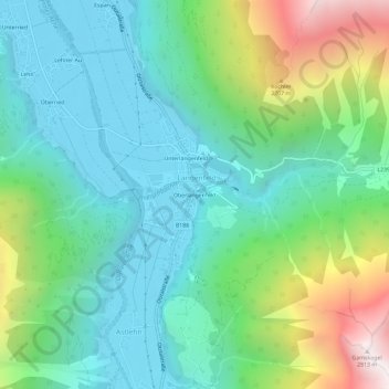
Name: Oberlängenfeld topographic map, elevation, terrain.
Average elevation: 1,584 m
Minimum elevation: 1,154 m
Maximum elevation: 2,796 m
Other topographic maps
Click on a map to view its topography, its elevation and its terrain.
Unterlängenfeld
Austria > Tyrol > Bezirk Imst > Gemeinde Längenfeld > Längenfeld
Average elevation: 1,590 m