
Tapurucuara (Macuana) topographic map
Interactive map
Click on the map to display elevation.
About this map
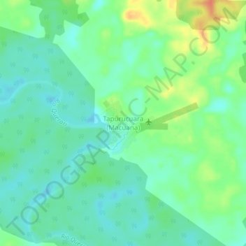
Name: Tapurucuara (Macuana) topographic map, elevation, terrain.
Location: Tapurucuara (Macuana), Mitú, Vaupés, Kolumbien (1.45216 -70.18712 1.49216 -70.14712)
Average elevation: 180 m
Minimum elevation: 166 m
Maximum elevation: 209 m
Other topographic maps
Click on a map to view its topography, its elevation and its terrain.