
Make a donation
Gear up for your next adventure:
As an Amazon Associate, this site earns from qualifying purchases at no extra cost to you.
Poltavka topographic map
Click on the map to display elevation.
Make a donation
Gear up for your next adventure:
As an Amazon Associate, this site earns from qualifying purchases at no extra cost to you.
About this map
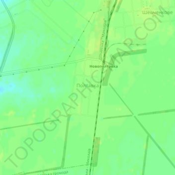
Name: Poltavka topographic map, elevation, terrain.
Average elevation: 92 m
Minimum elevation: 83 m
Maximum elevation: 97 m
Make a donation
Gear up for your next adventure:
As an Amazon Associate, this site earns from qualifying purchases at no extra cost to you.
Other topographic maps
Click on a map to view its topography, its elevation and its terrain.
Make a donation
Gear up for your next adventure:
As an Amazon Associate, this site earns from qualifying purchases at no extra cost to you.
Mykolaiv
Mykolaiv is located in a primarily flat terrain area, the fertile, grain-producing steppe region of southern Ukraine. The nearest mountains to Mykolaiv are 300 km (186 mi) south, at the southern end of the Crimean Peninsula. The lack of any mountain barriers north of Mykolaiv means that cold Arctic winds can…
Average elevation: 32 m
Mykolaiv
Mykolaiv is in a primarily flat terrain area (the steppe grain-producing region of southern Ukraine). The nearest mountains to Mykolaiv are 300 kilometres (186 miles) south, at the southern end of the Crimean Peninsula. The lack of any mountain barriers north of Mykolaiv means that very cold Arctic winds can…
Average elevation: 32 m
Make a donation
Gear up for your next adventure:
As an Amazon Associate, this site earns from qualifying purchases at no extra cost to you.
Mykolaiv
Mykolaiv is located in a primarily flat terrain area, the fertile, grain-producing steppe region of southern Ukraine. The nearest mountains to Mykolaiv are 300 km (186 mi) south, at the southern end of the Crimean Peninsula. The lack of any mountain barriers north of Mykolaiv means that cold Arctic winds can…
Average elevation: 32 m
Make a donation
Gear up for your next adventure:
As an Amazon Associate, this site earns from qualifying purchases at no extra cost to you.
Make a donation
Gear up for your next adventure:
As an Amazon Associate, this site earns from qualifying purchases at no extra cost to you.