Geolocate

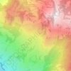
Mythen topographic map

Click on the map to display elevation.

About this map

Name: Mythen topographic map, elevation, terrain.

Location: Mythen, Schwyz, Switzerland (47.02919 8.68772 47.03019 8.68981)

Average elevation: 1,219 m

Minimum elevation: 613 m

Maximum elevation: 1,880 m

Other topographic maps

Click on a map to view its topography, its elevation and its terrain.

Rickenbach bei Schwyz

Switzerland > Schwyz > Schwyz > Schwyz

Average elevation: 751 m

Ibach

Switzerland > Schwyz > Schwyz > Schwyz

Average elevation: 555 m

Chäppeliberg

Switzerland > Schwyz > Schwyz > Schwyz

Average elevation: 1,115 m

Rickenbach

Switzerland > Schwyz > Schwyz > Schwyz

Average elevation: 751 m

Gear up for your next adventure:

❄️Walking Crampons - Added traction for icy slopes and winter peak bagging
🗺️Ordnance Survey Maps - Official UK maps for walking and outdoor activities
🔦Keychain LED Torches - Emergency backup light for finding gear in your pack
🔋Power Banks - Portable chargers for long outdoor trips
🔋Solar Chargers - Eco-friendly charging solutions for outdoor use

As an Amazon Associate, this site earns from qualifying purchases at no extra cost to you.