Geolocate

Stanley topographic map

Click on the map to display elevation.

About this map
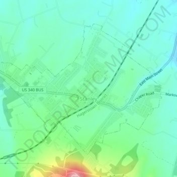
Name: Stanley topographic map, elevation, terrain.

Location: Stanley, Page County, Virginia, United States (38.56592 -78.52798 38.58807 -78.48668)

Average elevation: 328 m

Minimum elevation: 276 m

Maximum elevation: 490 m

Other topographic maps

Click on a map to view its topography, its elevation and its terrain.

Rileyville

United States > Virginia > Page County

Average elevation: 244 m

Luray Caverns

United States > Virginia > Page County > Luray

Average elevation: 277 m

Third Mountain

United States > Virginia > Page County

Average elevation: 704 m

Newport

United States > Virginia > Page County

Average elevation: 328 m

Shenandoah Forest

United States > Virginia > Page County

Average elevation: 371 m

Ida

United States > Virginia > Page County

Average elevation: 462 m

Gear up for your next adventure:

🎒Hiking Daypacks (20L) - Compact backpacks for day trips and technical mountain ascents
👕Merino Base Layers - Natural temperature regulation for cold weather hiking and camping
👟Waterproof Leg Gaiters - Keep mud and water out of your boots in boggy terrain
🔦LED Camping Lanterns - Illumination for reading maps inside your tent at night
❄️Walking Crampons - Added traction for icy slopes and winter peak bagging

As an Amazon Associate, this site earns from qualifying purchases at no extra cost to you.