
Puthencruz topographic map
Interactive map
Click on the map to display elevation.
About this map
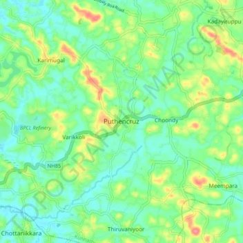
Name: Puthencruz topographic map, elevation, terrain.
Location: Puthencruz, Kunnathunad, Ernakulam, Kerala, 682308, India (9.92941 76.38325 10.00941 76.46325)
Average elevation: 25 m
Minimum elevation: 0 m
Maximum elevation: 79 m
Other topographic maps
Click on a map to view its topography, its elevation and its terrain.