
Santa Fe Island topographic map
Interactive map
Click on the map to display elevation.
About this map
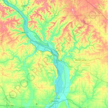
Name: Santa Fe Island topographic map, elevation, terrain.
Location: Santa Fe Island, Carroll County, Illinois, United States (41.80919 -90.51152 42.44919 -89.87152)
Average elevation: 238 m
Minimum elevation: 174 m
Maximum elevation: 369 m
Other topographic maps
Click on a map to view its topography, its elevation and its terrain.