Geolocate

Tenby topographic map

Click on the map to display elevation.

About this map

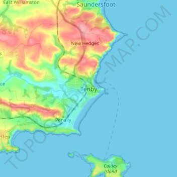
Name: Tenby topographic map, elevation, terrain.

Location: Tenby, Pembrokeshire, Wales, SA70 7JU, United Kingdom (51.63261 -4.74504 51.71261 -4.66504)

Average elevation: 21 m

Minimum elevation: -1 m

Maximum elevation: 101 m

Wales trails, hiking, mountain biking, running and outdoor activities

Gear up for your next adventure:

🧺Mesh Stuff Sacks - Breathable storage for wet gear or camp organization
🥤Hiking Water Bottles - Reusable bottles for hydration on the trail
🗺️Topographic Maps - Detailed maps showing elevation and terrain features
🔦Waterproof LED Headlamps - Hands-free lighting for evening treks and emergency navigation
👖Convertible Hiking Trousers - Versatile zip-off pants for changing mountain weather conditions

As an Amazon Associate, this site earns from qualifying purchases at no extra cost to you.