
El Natrun Valley topographic map
Interactive map
Click on the map to display elevation.
About this map
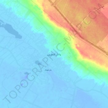
Name: El Natrun Valley topographic map, elevation, terrain.
Location: El Natrun Valley, The Lake, 22856, Egypt (30.33820 30.31521 30.41820 30.39521)
Average elevation: 5 m
Minimum elevation: -34 m
Maximum elevation: 55 m
Other topographic maps
Click on a map to view its topography, its elevation and its terrain.