
Boughton Malherbe topographic map
Interactive map
Click on the map to display elevation.
About this map
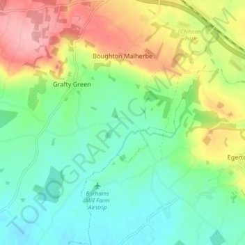
Name: Boughton Malherbe topographic map, elevation, terrain.
Average elevation: 75 m
Minimum elevation: 25 m
Maximum elevation: 164 m
Kent trails, hiking, mountain biking, running and outdoor activities
Other topographic maps
Click on a map to view its topography, its elevation and its terrain.
The Hernitage and High Noon Farm
United Kingdom > England > Kent > Maidstone > Detling
Average elevation: 145 m