
Racibórz topographic map
Interactive map
Click on the map to display elevation.
About this map
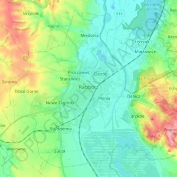
Name: Racibórz topographic map, elevation, terrain.
Location: Racibórz, Racibórz County, Silesian Voivodeship, Poland (50.04427 18.14102 50.13696 18.30250)
Average elevation: 210 m
Minimum elevation: 177 m
Maximum elevation: 294 m
Other topographic maps
Click on a map to view its topography, its elevation and its terrain.