
Kuata Island topographic map
Interactive map
Click on the map to display elevation.
About this map
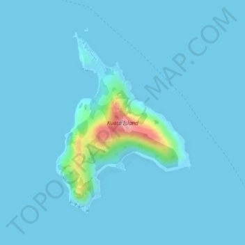
Name: Kuata Island topographic map, elevation, terrain.
Location: Kuata Island, Ba, Western, Fiji (-17.38003 177.13054 -17.36007 177.14616)
Average elevation: 10 m
Minimum elevation: -1 m
Maximum elevation: 164 m
Other topographic maps
Click on a map to view its topography, its elevation and its terrain.